Julia Davis
January 30, 2024
Professor Faisal Hossain helps lead NASA's SWOT satellite mission to aid in Bangladesh's water management.
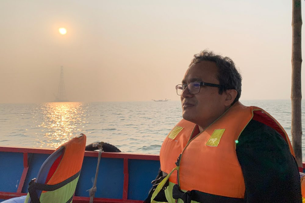
Hossain on a boat in Bangladesh on the Padma River during his December 2023 training workshop as part of NASA’s SWOT mission.
During a recent training workshop in Bangladesh, Professor Faisal Hossain continued his work as part of NASA’s newly launched Surface Water and Ocean Topography (SWOT) mission. The workshop included a series of training sessions for local stakeholders and marked a crucial step in implementing this space-based water tracking technology in Bangladesh.
The workshop was co-led by UW CEE graduate student Shahzaib Khan, University of North Carolina Professor and SWOT U.S. Hydrology Lead Tamlin Pavelsky, and Bangladesh Water Development Board (BWDB) member Arifuzzaman Bhuyan.
The SWOT mission, spearheaded by NASA and the French Space Agency (CNES) with contributions by Canada and the U.K., uses advanced radar interferometry technology to measure the elevation and coverage of Earth's surface water, including oceans, lakes and rivers. The project marks the first time scientists have been able to measure both the precise location and elevation of water, a notable advancement in global water monitoring.
By offering detailed insights into water volumes and their geographical distribution, SWOT enables scientists, policymakers and local authorities to better understand, monitor and manage water resources. This technology is particularly vital for Bangladesh, a country crisscrossed by rivers and frequently affected by monsoons, flooding and drought.
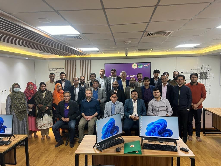
SWOT training workshop participants from Bangladesh Water Development Board (BWDB), including CEE Professor Faisal Hossain (front, left) and CEE graduate student Shahzaib Khan (front, right).
As one of the leads in developing SWOT's application plan over the past decade, Hossain has been instrumental in bridging the gap between cutting-edge technology and practical implementation for users around the world. Bangladesh, a delta nation at the extensive delta of the Ganges River where it meets the Bay of Bengal, faces existential threats from climate extremes and rising demands for water, food and energy. This region, largely covered with a swamp forest, is one of the world's most densely populated areas and is particularly vulnerable to climate change.
Understanding these challenges, Bangladesh has recognized the potential of the SWOT mission to address and mitigate these critical issues. The government, in preparation for SWOT's launch, has already invested in setting up sensors and probes around the country and currently maintains numerous manual and automatic gauges for surface water tracking. This investment aligns with the country's ambitious Delta Plan 2100, a national master plan focusing on improving water-food security and mitigating the impacts of floods and droughts.
Hossain and his research group, comprised of graduate students like Khan, have played a vital role in preparing the Bangladeshi government to effectively use SWOT data. This involves not just knowing where to access the data but also capacity building and training local engineers and scientists to interpret and make decisions accordingly.
The anticipated impacts of the SWOT mission in Bangladesh are profound. By combining SWOT data with other satellite resources, local engineers and agricultural officers will gain unprecedented insights into water dynamics. This information is crucial for making informed decisions about crop sowing and harvesting, optimizing irrigation during dry months, and effectively managing flood and drought conditions.
Hossain's passion for water resource management stems from his diverse experiences in countries with varying water challenges. His commitment to making access to water information a fundamental right has been a driving force behind his involvement in SWOT since its early days in 2008.
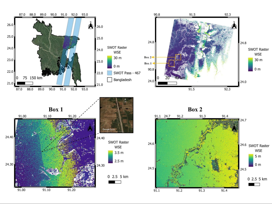
Example of how the SWOT satellite mission tracks surface water over Bangladesh to aid in decision-making and planning for water management. The upper left panel shows the path of the SWOT mission passing over Bangladesh. The upper right panel shows how the surface water level is detected at a high spatial granularity over the region that is wet and inundated with newly formed wetlands during the SWOT overpass. The lower left and right panels show a close-up view of how well SWOT can pick up the nuances on the surface. The lower left panel shows the presence of a road embankment where a higher water level on the upstream (eastern) side is evident. For the lower right panel, a small river’s slope can be detected using SWOT data to understand its direction of flow. Such granularity and ability to track both the extent and elevation of surface water was not possible until the launch of the SWOT mission. Image credit: Shahzaib Khan, UW Civil and Environmental Engineering.