
By Julia Davis
June 2, 2026
A new model maps landslide risk for every building in Seattle, capturing not just unstable slopes but where debris would go.
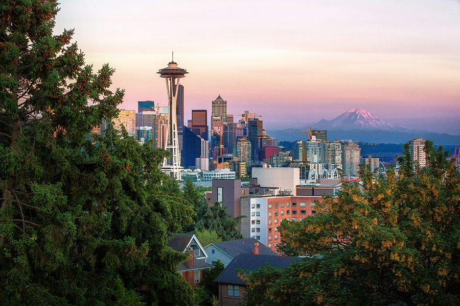
For the first time, UW researchers have produced building-level landslide risk maps for the city of Seattle, the kind of quantitative risk mapping experts have called for since the deadly 2014 Oso landslide in Washington state, which killed 43 people.
The study introduces a model called MM3 that goes beyond the susceptibility maps Seattle currently uses to guide land use decisions. Those maps show where slopes may be unstable, but don’t account for the timing of failures, the path of debris or the consequences for people and property. MM3 estimates all of those factors for every building in the city.
“A big limitation to the way landslide hazard maps have traditionally been developed is that they identify the source, but not what happens after a landslide starts to move,” says CEE Professor Joseph Wartman, who co-led the study. “You can have a house that is not in a landslide zone that gets impacted by a landslide.”
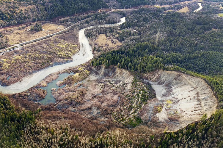
When debris runout is included, the area potentially affected by landslides expands by roughly 80%. And many of the buildings at risk aren’t where you’d expect: about 58% of those flagged by MM3 as carrying substantial risk fall outside Seattle’s current landslide-prone designations.
The study also highlights how sharply risk can differ between neighboring properties. During Hurricane Helene, for example, residents reported that their homes were hit by landslides while neighbors just 100 feet away were untouched. That’s because landslides “channelize” and follow narrow paths shaped by the terrain, making their impacts hyper-local. A home at the base of a slope may face fast-moving debris slides, the type most dangerous to people, while a home near the crest faces slower failures that undercut foundations.
If the risk in Seattle is controlled by precipitation-induced landslides, the best value for our mitigation efforts and policies would be to focus on those.
Professor Joseph Wartman
The study also answers whether Seattle’s landslide risk is driven more by rainfall or by earthquakes. Frequent, rain-triggered landslides account for about 62% of the threat to human life and 70% of structural damage over time. During Seattle’s wet winters, rainfall seeps through loose glacial soil until it hits a denser layer it can’t penetrate, building up water pressure that weakens the ground and can trigger a slide.
That doesn’t mean earthquakes aren’t a concern, but because they are rare, the response is more about emergency preparedness, like planning evacuation routes, rather than ongoing slope-by-slope mitigation efforts that address rain-triggered risk.
“If the risk in Seattle is controlled by precipitation-induced landslides, the best value for our mitigation efforts and policies would be to focus on those,” Wartman says.
The study was co-led by William Pollock (CEE Ph.D. ‘20), who developed MM3 over nearly a decade of research at the UW, and was funded by the National Science Foundation.
Related story
After Oso, what did we learn about preventing disaster?
Earlier this year, Professor Joseph Wartman was featured in a Seattle Times piece investigating landslide mapping progress since the 2014 Oso landslide.