
December 12, 2022
New approach, not in the Clean Air Act, could eliminate air pollution disparities
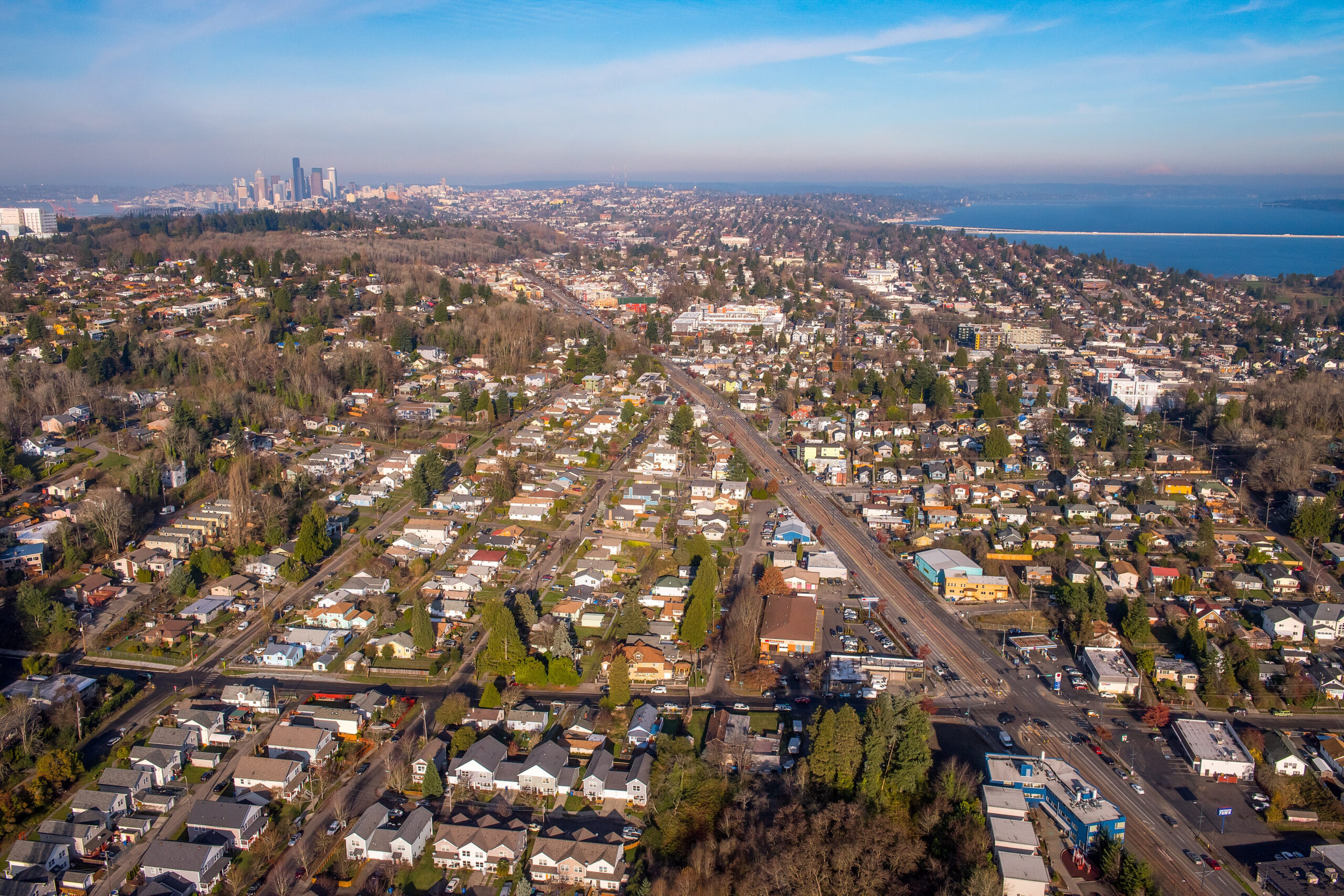
While air quality has improved dramatically during the past 50 years thanks in part to the Clean Air Act, people of color at every income level in the United States are still exposed to higher-than-average levels of air pollution. A team led by CEE researchers wanted to know if the Clean Air Act is capable of reducing these disparities, or if a new approach is needed. The team compared two approaches that mirror main aspects of the Clean Air Act and a less common third approach to evaluate if it could better address disparities across the contiguous U.S. The researchers used national emissions data to model each strategy. Although the first two approaches didn’t resolve the disparities, the third approach — which targeted emissions in specific locations — eliminated pollution disparities and reduced pollution exposure overall. Implementing this location-specific approach would require additional work to identify which locations would be the best to target and also working with communities to identify how to reduce emissions, the researchers say. The findings were published in the Proceedings of the National Academy of Sciences by the team, which includes Professor Julian Marshall and Ph.D. student Yuzhou Wang.
Snow Spotter: Uncovering snow’s effect on summer water supplies
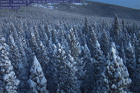
When falling snow is intercepted by trees, it sometimes never makes its way to the ground. As a result, current models struggle to predict exactly how much water will be available from the snowpack in forested regions. To improve the models and investigate what happens to intercepted snow, UW CEE researchers created a citizen science project called Snow Spotter. A total of 6,700 volunteers viewed time-lapse photos from remote locations in Colorado and Washington, collectively scanning 13,600 images and identifying which photos showed trees with snow in their branches. This information provided the first glimpse of how snow-tree interactions may vary between climates and affect predictions of summer water supplies. There are three possible scenarios for snow that’s been caught by trees. It could fall to the ground and add to the current snowpack; it could blow away and turn to water vapor and not contribute to the snowpack; or the snow could melt and drip to the ground, which may not add to the snowpack. The findings were published in AGU Water Resources Research by the team including Ph.D. student Cassie Lumbrazo, alumni Andrew Bennett and William “Ryan” Currier, and faculty Bart Nijssen and Jessica Lundquist.
Wave sensors deployed in Florida to improve hurricane forecasts
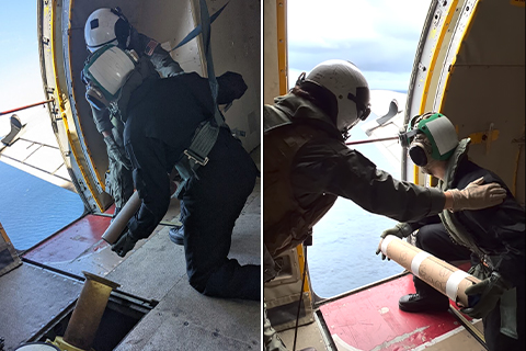
In late September, researchers dropped technology developed at the UW off the coast of Florida to measure ocean waves in the path of Hurricane Ian. Led by Professor Jim Thomson and Ph.D. student Jacob Davis, the test was part of a broader effort to improve forecasts for the fast-moving and deadly weather systems. Members of the U.S. Navy’s VXS-1 Squadron helped deploy the equipment in the path of Hurricane Ian before the hurricane made landfall. The researchers used a smaller version of the UW-built sensors known as the Surface Wave Instrument Float with Tracking (SWIFT), which in the past have been deployed to study waves in the changing Arctic Ocean. The smaller microSWIFT sensors drift with the waves to gather detailed measurements of waves and currents at the ocean’s surface. The researcher’s current effort in the path of Hurricane Ian aims to understand how the extreme low-pressure storm system affects the ocean and, ultimately, coastal areas. Part of a collective effort to improve hurricane forecasts, the microSWIFT observations at the ocean’s surface will be combined with other observations, including technologies deployed on the same flight by Scripps Institution of Oceanography and Sofar Ocean Technologies.
New initiative: Computing for the Environment
To accelerate research addressing climate change, pollution, biodiversity and more, Computing for the Environment (CS4Env) brings together civil and environmental engineering researchers, computer science engineers, environmental science researchers and data scientists.
The cross-disciplinary research teams from Civil & Environmental Engineering, The Paul G. Allen School of Computer Science & Engineering, the College of the Environment, and the eScience Institute are applying technologies and tools — including deep learning, data visualization, software engineering and machine learning — to address topics ranging from air quality and wildlife conservation to wildfires and landslide risk. CS4Env launched this past summer with 12 inaugural projects.
“Research to slow down the impacts of climate change requires a multidisciplinary approach involving a lot of data collection and analysis,” says Professor Dorothy Reed, one of CS4Env’s three directors. “For example, some of us in CEE have lots of domain expertise, but face challenges in collecting and processing huge datasets.”
Also leading the initiative are Vikram Iyer, an assistant professor in The Allen School, and Alex Turner, an assistant professor of atmospheric sciences.
“One of the aims of CS4Env is to provide a platform that brings together researchers with expertise that allow us to tackle big interdisciplinary problems in the environment,” Turner says.
The initiative provides seed funding for research teams to explore new projects. To facilitate the sharing of information, the researchers gathered during autumn quarter for biweekly presentations, and to discuss the broad range of topics funded by the initiative.