
By Julia Davis
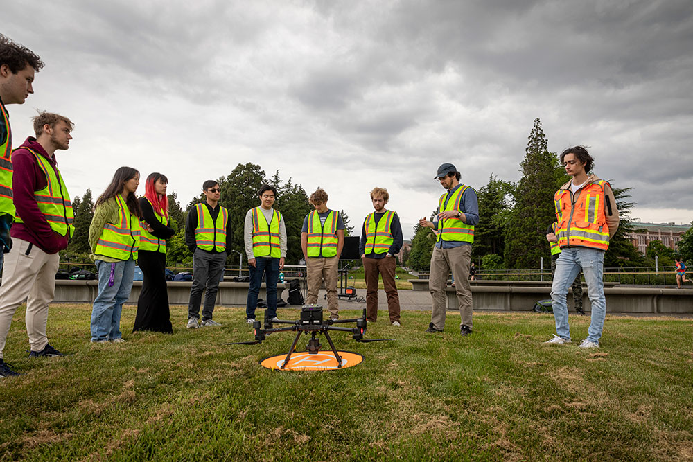
David Shean shows students the drone used to collect information for 3D modeling. Photo by Mark Stone.
Some visitors walking along the UW’s iconic Rainier Vista last spring got to witness a free drone show, thanks to a popular CEE workshop that allows first-year students to collect data using LiDAR drones on campus.
The energy that freshmen engineering students bring is one of my favorite parts of this workshop. They're so excited to be there and in some cases, this is the first real hands-on engineering they've gotten to do since arriving at the UW”
“The energy that freshmen engineering students bring is one of my favorite parts of this workshop. They're so excited to be there and in some cases, this is the first real hands-on engineering they've gotten to do since arriving at the UW,” says CEE Assistant Professor David Shean, the instructor of the workshop.
Shean introduced the “Drones n’ Lasers” workshop in 2022 to expose first-year students to some of the cutting-edge technology that engineers use to produce accurate 3D models. These models are used in nearly all areas of civil and environmental engineering – construction, geotechnical assessment, water resource management, natural hazard research and more.
LiDAR, which stands for Light Detection and Ranging, is a remote sensing technology that utilizes laser beams to precisely measure distances between the sensor and the Earth's surface. The LiDAR system emits rapid pulses of laser light at a specific target and then measures the time it takes for the reflected light to return. These drones collect thousands of points per second, which are then used to produce detailed and accurate 3D representations of the landscape. The ability to quickly capture high-resolution data over challenging terrain and densely vegetated areas gives LiDAR-equipped drones a significant edge in various industries and research endeavors.
The two-day workshop for students is a mix of theory and practice. Day one begins with an introductory presentation and group discussions about mission planning. This is followed by outdoor fieldwork where students configure and operate the LiDAR drone to survey Rainier Vista. After gathering this information, the students spend the second day of the workshop processing the data they collected and analyzing the resulting 3D models.
“Ideally, this workshop will inspire students who hadn’t considered CEE and geomatics as a potential career path. And hopefully they’ll go on to innovate, make a difference in the world, and use these tools to address some of the big issues that we’re facing today,” Shean says.
The workshop is one of many offered by the College of Engineering with the goal of allowing first-year students to try out different areas of engineering that they may be interested in.
Originally published December 7, 2023