
By Brooke Fisher
Photos: Dennis Wise/University of Washington and Yakama Nation
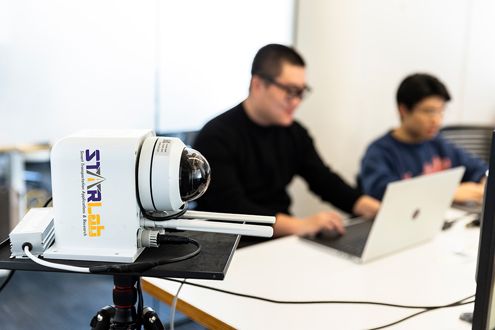
Testing the sensor performance are Wei Sun, CEO of AIWaysion, and George Ma, Software Developer of AIWaysion, from left.
In addition to the cherries, asparagus and hops that grow along a stretch of U.S. Highway 97 in the heart of Yakima Valley’s agricultural corridor, something else has taken root in the community: a data-driven approach to improve traffic safety and save lives at Yakama Nation’s deadliest intersection.
“With the agriculture comes farm vehicles, farm workers, freight and bigger trucks on roads that were built in the 1940s, ’50s and ’60s, so they are not to today’s standards,” explains HollyAnna Littlebull, the Traffic Safety Coordinator for Yakama Nation Department of Natural Resources Engineering. “There is often a line-of-sight issue — crops come right up to the intersection so sometimes you can’t see if there’s oncoming traffic.”
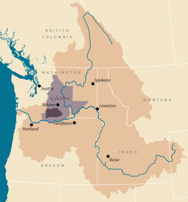
The location of Yakama Nation in dark purple. Click to enlarge.
Along the precarious highway corridor, where more than 430 serious injuries and 24 fatalities have occurred in the past 20 years, contributing factors include speeding, texting while driving and pedestrians walking along the highway shoulder. In her ongoing work to advocate for safety improvements, Littlebull often hasn’t had enough data to make generalizations — but that is changing.
To provide real-time data about the nature of traffic collisions, as well as monitor traffic, roadway and environmental conditions, a Mobile Unit for Sensing Traffic (MUST) sensor was installed at the deadliest intersection on the reservation in November 2022. A partnership between Yakama Nation Department of Natural Resources, UW Smart Transportation Applications & Research (STAR) Lab researchers and associated spin-off company AIWaysion, the pilot project is funded by the Pacific Northwest Transportation Consortium (PacTrans).
“Facts are important — we are utilizing the data to tell us what the reality is that we are facing,” Littlebull says. “So far, it’s the best tool that we’ve ever had to give us current and up-to-date information. We want to make the best decisions possible to reduce fatalities and serious injuries.”
An AIWaysion researcher works on a vehicle detection algorithm.
A sensing solution
Since 2008, STAR Lab researchers have been working on iterations of the MUST sensor, which began as a Bluetooth sensing experiment. The current technology integrates several functions in one device: a camera, environmental sensors, communication functions and advanced analysis that incorporates multiple data sources and is capable of making decisions.
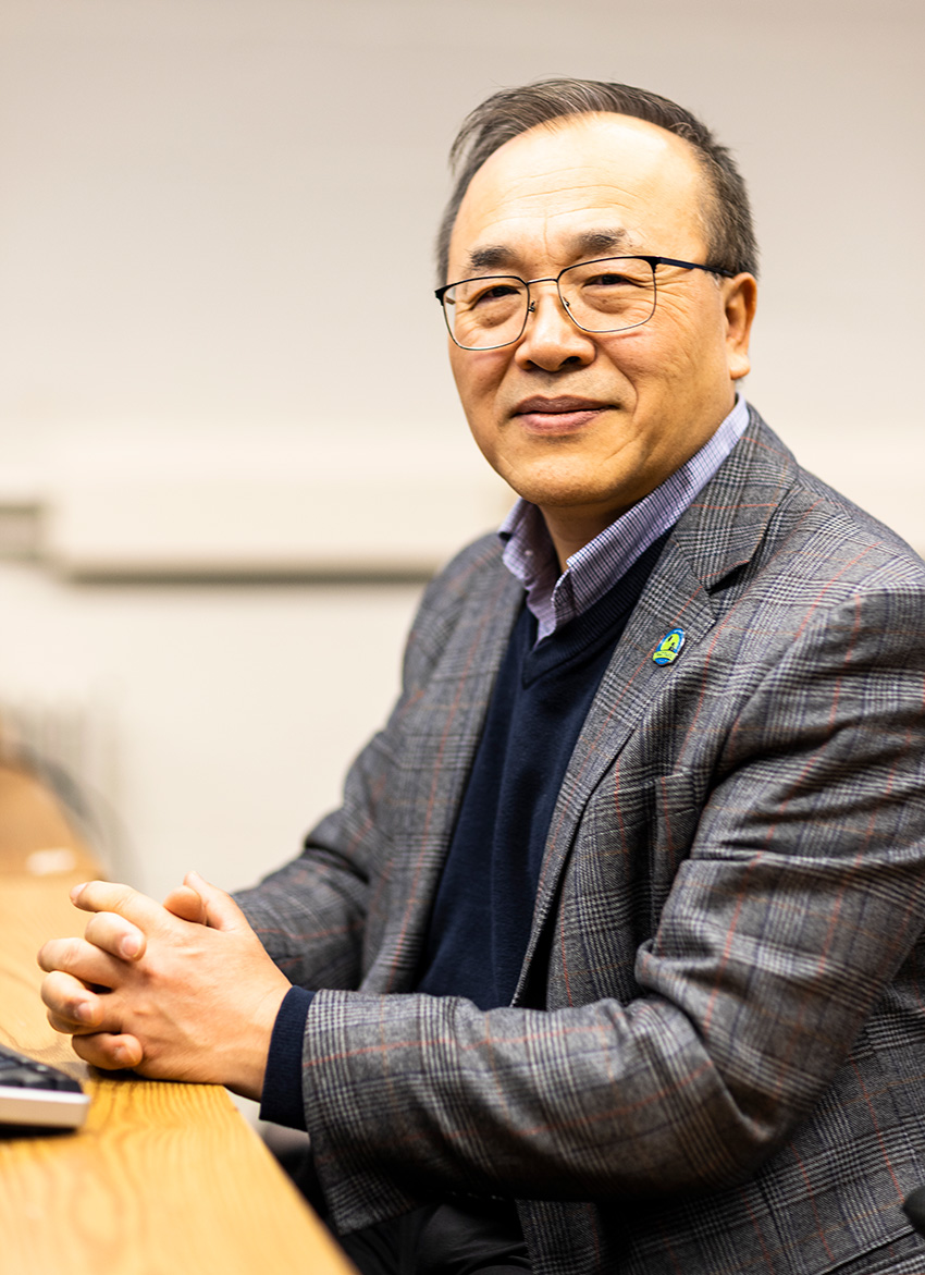
Professor Yinhai Wang in the STAR Lab.
“Everything is done by the sensing device — it detects and processes information and decides what kind of warning information to send directly to the traffic center,” says Professor Yinhai Wang, who has overseen the sensor development. “Our students do computer science, mechanical design and control theory, so we are using all these different technologies to break boundaries and optimize the solution.”
Information captured by the sensor is sent to Yakama Nation’s traffic management center, where traffic engineers can view the data in real-time on a dashboard and also via an app for after-hours monitoring. Thanks to edge computing capabilities, in which data is processed and stored locally on a device instead of via the cloud, the sensor works well in remote and rural areas with limited internet access.
“The sensor provides real-time information like vehicle volume and speed, road surface and weather conditions and the presence of pedestrians and semi-trucks. It also detects possible near-miss collision events,” explains Wei Sun, the CEO of the spin-off company AIWaysion. “If certain events are happening, it can send out a warning message and traffic engineers can drive there to check it out.”
Understanding a deadly intersection
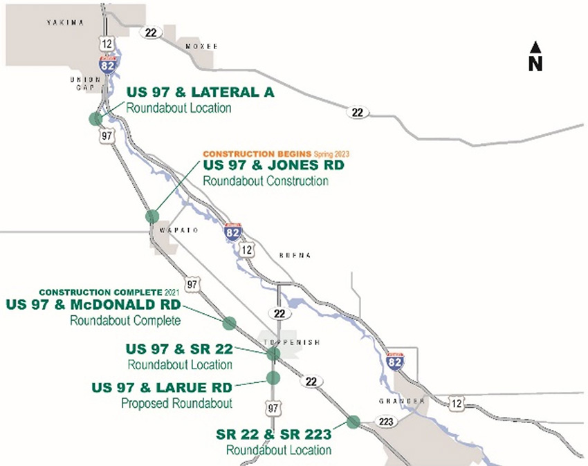
The location of six roundabouts that will be installed along the precarious highway corridor. Click to enlarge.
Better understanding the nature of traffic collisions along Highway 97, specifically at the Larue Road intersection — where seven of 24 fatalities have occurred between the towns of Union Gap and Toppenish since 2001 — is a priority for Littlebull. Collision reports often don’t include the direction of travel, and weather conditions are not specified.
“The fog here can be so thick that you can’t see 200 feet. That’s not in the report. I need to see the environmental factors and behavioral factors,” explains Littlebull. “The other thing I don’t get from the reports is the traffic volume and the speed that cars are going. I know speeding is an issue, but if I can’t prove it, that’s a problem.”
To help improve safety along the highway corridor, Washington State Department of Transportation is installing six roundabouts. While construction of a roundabout at Larue Road may be a few years out, the first installation at McDonald Road in 2021 has proven successful. More than six million vehicles have traveled through the roundabout with only a handful of minor collisions — and no fatalities.
A related concern that Littlebull is also advocating for is improvements to first responder services. While two ambulance providers serve the reservation, the only one that has paramedics trained to handle severe trauma responds from Yakima.
“It’s a huge issue. We are so remote, so spread out — there’s no way people will receive advanced life support within the 10-minute bubble, or the ‘golden hour,’” Littlebull explains. “I’m trying to paint that picture with as much data as I can get, to justify to people who hand out grants that this is why we need higher trained EMTs and safer roads for all.”
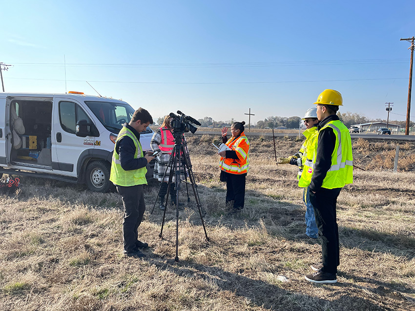
On-site interviews by local media during the installation of the first MUST device at the Highway 97 & Larue Road intersection in Toppenish, Washington.
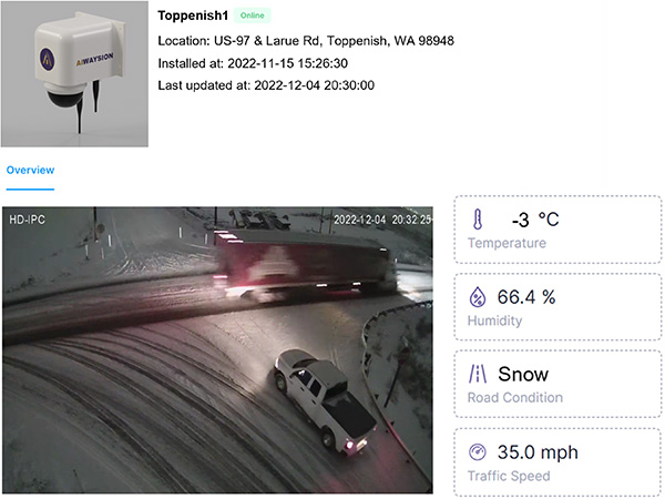
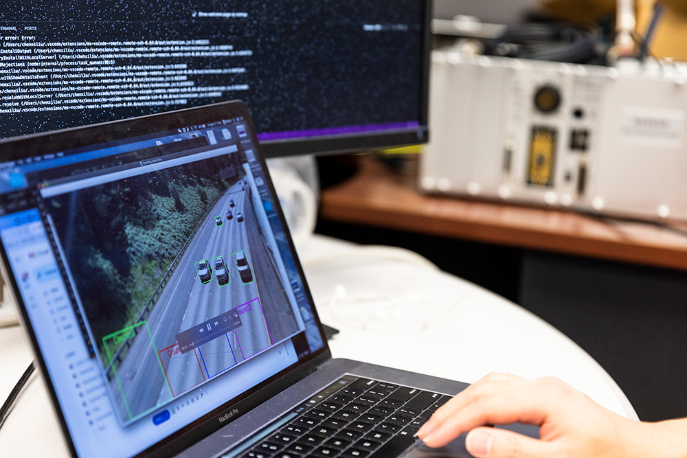
The Larue Road intersection on a snowy evening, as shown on the dashboard for data management and visualization, which traffic engineers can view in real-time.
Data developments
When I lobby and talk to elected officials, I make it a story. I help them realize that these fatalities are not just dots on a map, these are human lives. I take the data, personalize it and hit them where it hurts — in the heart. That is what the UW is helping me do, they are helping me tell the stories.”
To enhance safety at the Larue Road intersection, the researchers are working to roll out more technology features. For example, if the sensor detects a traffic collision, it could be programmed to automatically alert emergency responders. Or, if unsafe driving conditions are detected, the sensor could prompt a warning message on an electronic reader board.
“The sensor could detect if black ice or snow is covering the road surface and issue a warning,” Wang explains. “This would enable people to avoid the area or drive at a very low speed.”
To expand the pilot project, AIWaysion and Yakama Nation are seeking funding to deploy additional sensors along the highway corridor. Although the pilot is intended to last up to 18 months, Littlebull hopes to utilize the technology much longer — perhaps indefinitely.
“When I lobby and talk to elected officials, I make it a story. I help them realize that these fatalities are not just dots on a map, these are human lives,” Littlebull says. “I take the data, personalize it and hit them where it hurts — in the heart. That is what the UW is helping me do, they are helping me tell the stories.”
Spin-off specifics
To commercialize the MUST sensor technology, AIWaysion launched in 2022. In addition to start-up support and mentorship from UW CoMotion, funding was also provided by a U.S. Department of Transportation Small Business Innovation Research Award. Orders are starting to stream in and the team hopes to sell 100 sensors by the coming summer.
Originally published May 15, 2023