
By Julia Davis
January 8, 2026
What happens to traffic when streets become dining rooms, plazas and play streets instead of car lanes? Researching this pandemic-era question earned UW CEE graduate Jeremy Chan (MSCE ’25) the UW Graduate School’s 2025 Distinguished Thesis Award in the Mathematics, Physical Sciences and Engineering category.
His thesis, “Repurposing City Streets: Assessing City-Scale Congestion and VMT Impacts with a System Dynamics Scenario Analysis,” was selected for the Graduate School honor, which recognizes outstanding scholarship at the master’s level across the entire university and comes with a $1,000 honorarium.
Chan, who completed his master’s degree in civil engineering with a transportation focus earlier this year, is only the second CEE graduate student to receive the award.
A long-standing interest in how cities move
Jeremy Chan
Chan’s path to the project reflects a long-standing curiosity about how cities work. He was born in Hong Kong and grew up in Australia, where he completed a double bachelor’s degree in aerospace engineering and in math and physics. Before coming to the UW, he spent five and a half years as a middle and high school math teacher, including in Melbourne, Australia, and Dallas, Texas.
“I’ve always had an interest in transportation,” he says. “When I was very young, I used to read the street directory, kind of like the modern equivalent of just scrolling through Google Maps. I was fascinated by how cities are designed, how they come to be and how people get around.”
Moving from Australia to the United States made those questions feel more urgent, and seeing how differently cities are designed in North America ultimately led him to choose the transportation discipline when he applied to CEE.
“I was interested in how we could make our cities, streets and public transit more equitable and safe, especially given how car-oriented a lot of American cities are,” he says.
What happens when streets are used for more than cars?
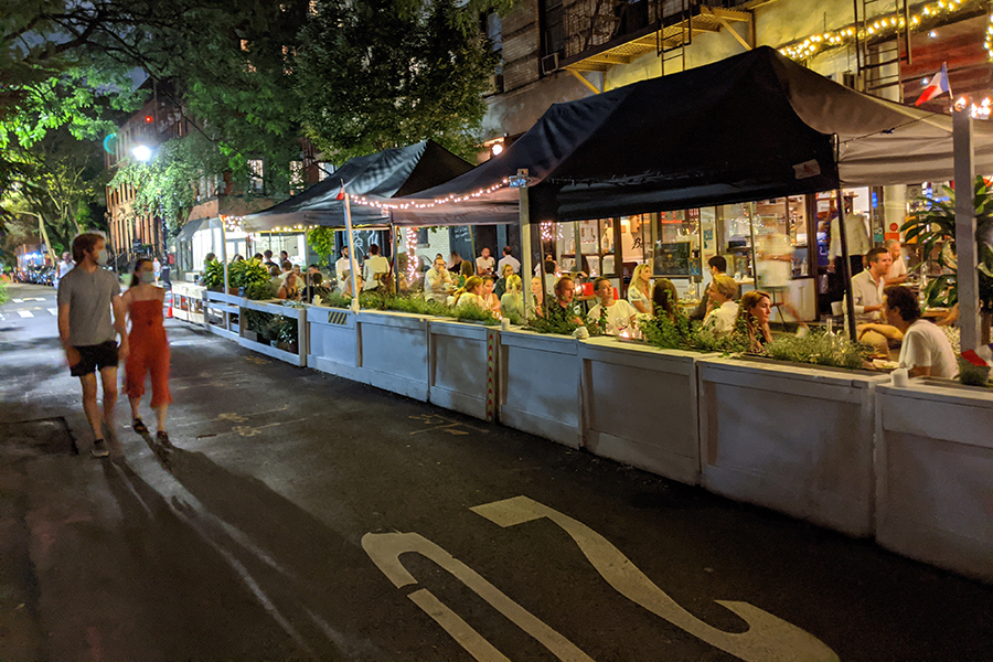
Chan’s research was inspired by the transformation many cities underwent during the COVID-19 pandemic, when quieter streets became outdoor dining rooms, pedestrian plazas, play streets and bike lanes.
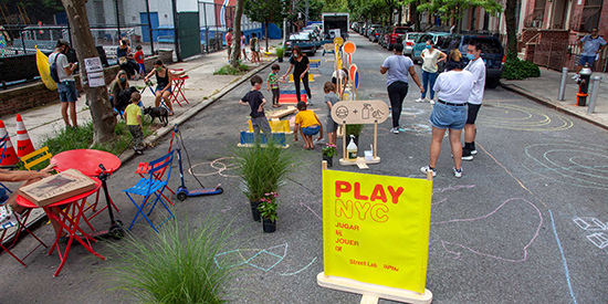
Families and children enjoy a “Play NYC” open street in New York City, with games, chalk drawings and temporary seating replacing car traffic for the day.
He set out to understand what would happen if cities built more of these “alternate street uses”: how they would affect congestion, total vehicle miles traveled and mode share, or the proportion of trips taken by car, on foot or by transit.
In his work, these alternate street uses include commercial activities such as outdoor dining, social and recreational spaces like play streets and plazas, infrastructure for walking and biking, and bus or transit-priority lanes. The goal was to understand how using existing street space in these ways could support safer, more equitable and less car-dependent mobility at the city scale — not just on a single block.
Modeling citywide change
To understand how changes in street use ripple through an entire urban transportation system, Chan used a methodology called system dynamics, which is designed to capture how different parts of a system influence one another over time.
“System dynamics is based on relationships between all the variables,” he says. “From a very basic model you could build, it’s kind of like a mechanical spring system: if you push on one part of the model, then another part bounces around.”
In place of springs, his model includes equations that describe how factors such as congestion, travel speed, investment in walking and cycling, transit service levels and activity choices interact. Chan built the model from scratch, drawing on published research to define those relationships.
He created two versions of the model, one representing Seattle and one representing Phoenix, to compare a denser city with higher transit use and a city more dependent on cars. The work grew out of a National Science Foundation-funded grant led by Professor Cynthia Chen, who advised Chan’s thesis, and was a collaborative effort among CEE, the College of Built Environments and partners at Arizona State University. The project focused on what cities could learn from their rapid street adaptations during COVID-19.
You need to go all in applying these changes in many locations around the city so that you see the overall benefit."
The results paint a nuanced picture of congestion and driving. In both cities, repurposing more street space for “destination” uses such as outdoor dining, street markets, park space and play streets reduced congestion, in part because these uses encouraged more people to walk or bike to nearby places. When street space was repurposed for walking and cycling, some scenarios showed congestion or total driving getting worse before improving, suggesting that scattered or one-off projects may not reveal the full benefits of a more connected network.
“Removing a lane from a specific street may make congestion worse on that street at certain times — but reduce congestion at a city level,” Chan says. “So, if you only make changes on one street, then you get more traffic on that street without having any system-level benefits. You need to go all in applying these changes in many locations around the city so that you see the overall benefit.”
Earlier this year, he shared preliminary findings at the annual meeting of the Transportation Research Board in Washington, D.C., where he presented the work to researchers and practitioners from across the field.
Looking ahead, Chan hopes the ideas from his thesis can help cities think more ambitiously about the uses of their entire network of streets.
“It would be helpful for planning agencies to think about how different uses of streets could be spread across many parts of the city, so we can better use street space that often sits idle for most of the day,” he says.